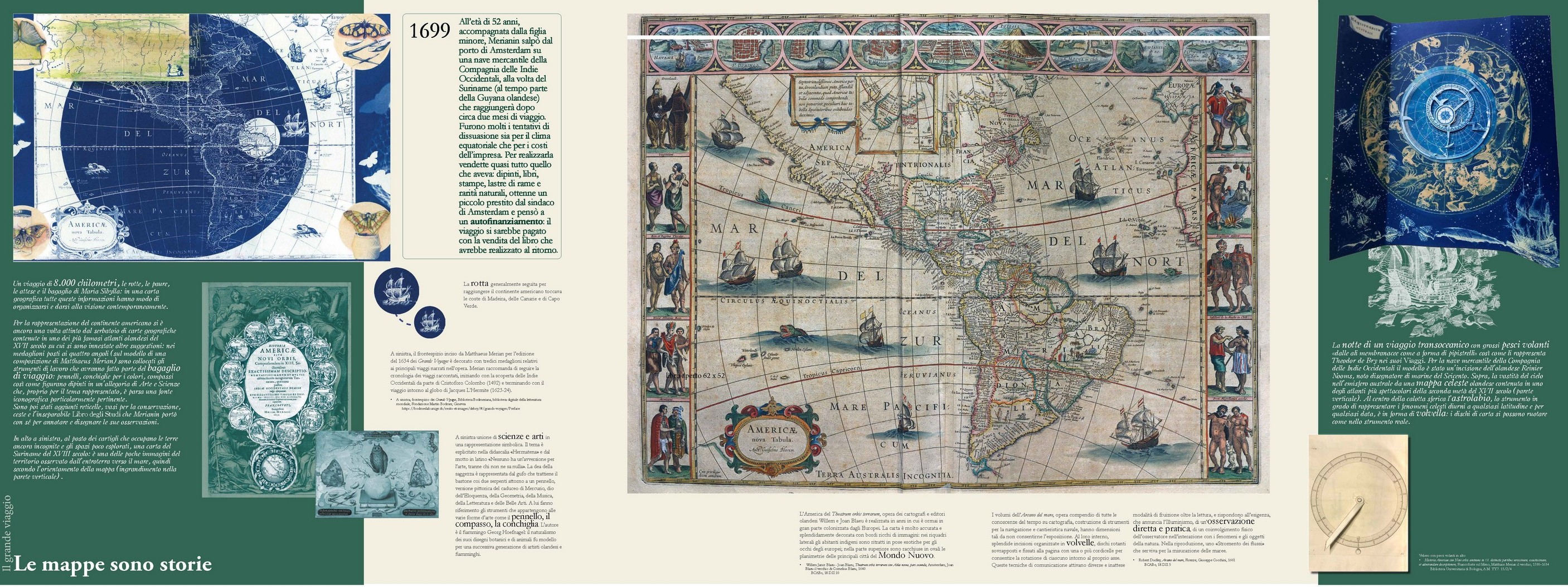

In June 1699, at the age of 52 and accompanied by her youngest daughter, Merianin set sail from the port of Amsterdam on a West India Company merchant ship bound for Suriname (at the time known as Dutch Guiana), which she reached after about two months of travel. There were many attempts to deter her from going due to both the equatorial climate and the cost of the venture. In order to cover the latter, she sold almost everything she had: paintings, printed books, copper plates, and natural rarities,; she obtained a small loan from the mayor of Amsterdam and thought about a form of self-financing: the journey would be paid for with the sale of the book on Surinamese insects and plants that she would produce upon her return.
In the showcase there are several maps to follow Merianin’s journey: a map of America, drawn from a 17th- century Dutch map atlas, and a representation of the celestial vault of the southern hemisphere. Accompanying them are a tide gauge and an astrolabe in the form of a volvella. On the vertical wall, a map of Suriname and views of the capital Panamaribo, the only vast urban agglomeration even in Merianin’s time.